Trojeborgar

GPS

The coordinates of the visited labyrinths were taken directly in the center by using the GPS receiver Garmin geko 201 with an accuracy of about 10 m.
Coordinates from labyrinths in churches are measured some meters outside the building.
To give details about the geographic latitude and longitude of a labyrinth is therefore to be seen as the worldwide valid address for a labyrinth, as it is the city, the street, and the number for a house.
With that a labyrinth can be exactly described, and may be refound at any time.


Labyrinth data-baseYou can use that for instance to give the geographic coordinates in the worldwide data-base for labyrinths, in the WWLL ... Link >


South Sweden

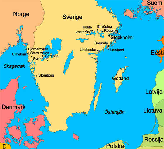
South Sweden and the countries around

The map of South Sweden

The visited places are indicated. By clicking them you open a Google Earth placemark, which will fly you directly to the place after you have opened it. But you will not see the labyrinth itself. The quality of the satellite images from Sweden is at present (2007) not good enough to show them.

In other countries, especially in urban areas, the quality is sufficient for that.

Here some examples:

Labyrinth in front of Grace Cathedral in San Francisco USA >
Turf labyrinth in Hilton England >
Schoolyard labyrinth in Würzburg Germany>


< back to the 1st part


Home


to the map of Gotland nach Ulmekärr nach Stora Anrås nach Grinstad nach Björnemyren nach Svartborg nach Storeborg nach Tibble nach Västerås nach Enköping nach Rösaring nach Sorunda nach Lindbacke nach Landsort